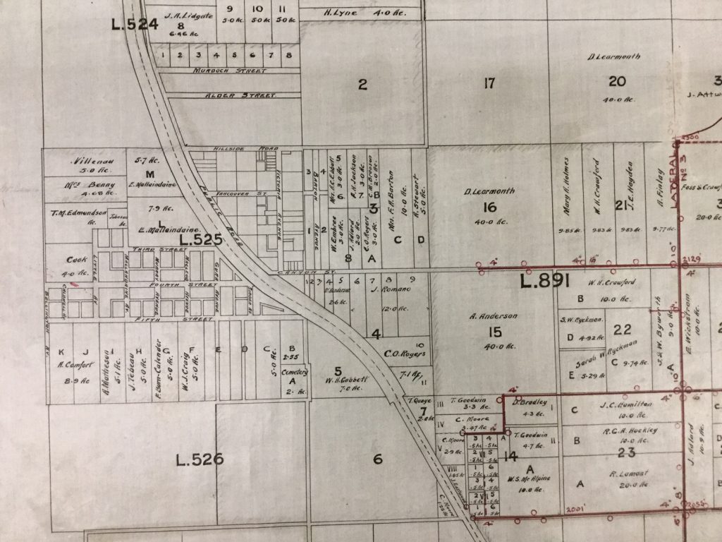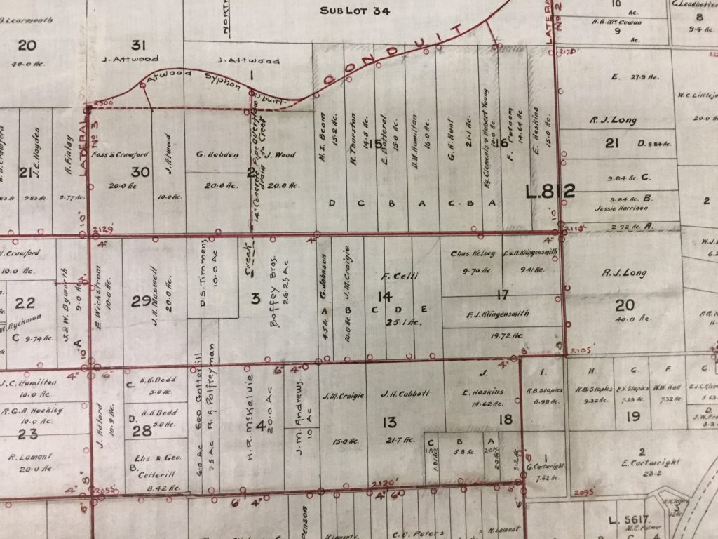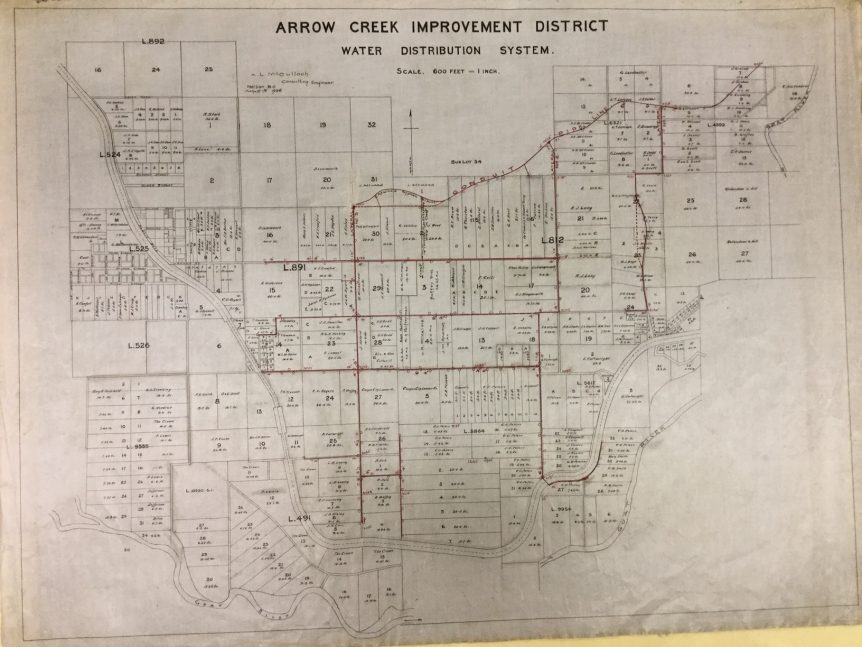
While I’m busily getting sidetracked with maps, let me just show you my absolutely favouritest (yes, I’m sure that’s a word!) map in the entire archives’ collection:
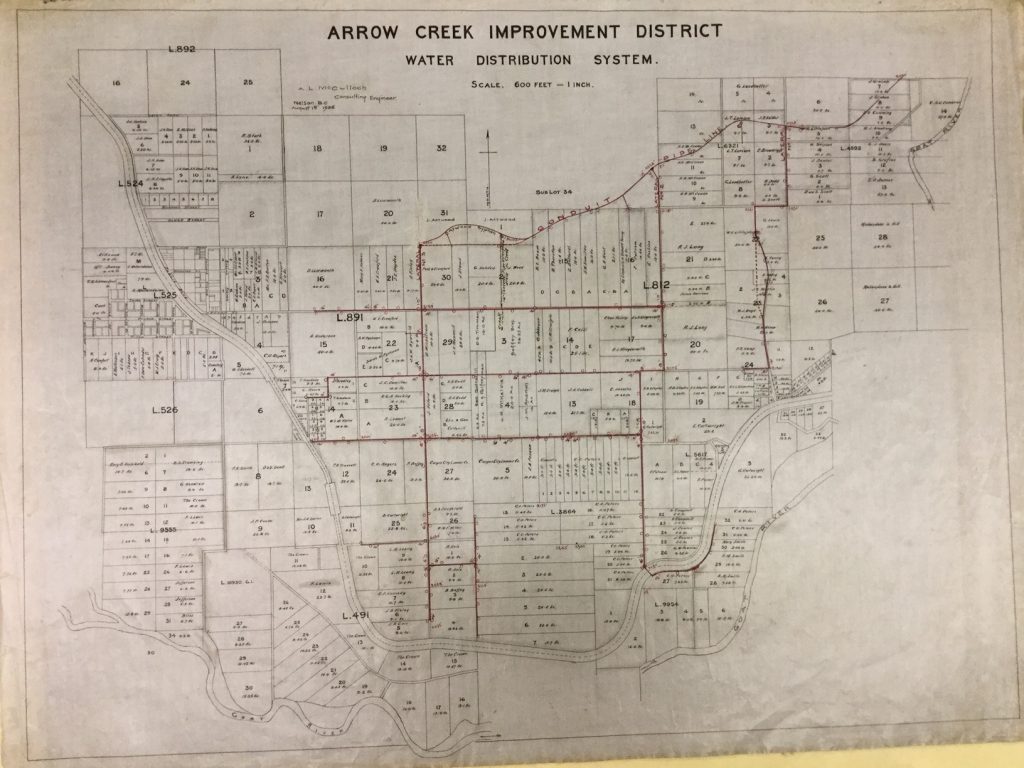
This is from 1926, and shows the planned placement of irrigation pipes for the Arrow Creek Improvement District… that is to say, most of Erickson. This is the system that went into operation in 1930, and which is still in use today – though much of the original concrete pipe has now been replaced.
This map is kind of cool because it shows the network of irrigation lines and the extent of the orchard properties it served – but it is really, super, awesomely cool because it also shows the various properties, complete with Lot and Block numbers, and the names of their owners.
When you work constantly from references in newspapers that refer to “the Dodd place,” or with recollections of long-timers who say it’s “where Old Mr. Penson used to live,” or orchard surveys that say the surveyed property is “half a mile southwest” of the centre of town – believe me, a map like this is a godsend.
We get quite a few property research requests – people wanting to know who owned their property or when a house was built – and this map is always my starting point if the property in question is (or was) an orchard property. The current owners can usually give us the legal description, and of course the street number, and then we can compare that to the streets and lot numbers on the map and figure out who owned the property in 1926. From there, it’s easy to search the newspapers (at least up to 1935) to find the owners before and after, and a lot of the time we can get recent-enough information from the newspapers to link the property to someone that one of the local long-timers might remember.
Here are a couple closer photos of sections of the map, for your getting-sidetracked pleasure: